The French Army in the Chesapeake
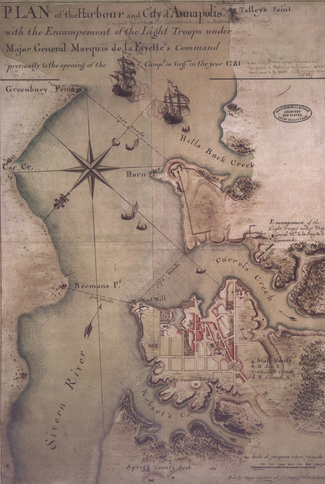
The presence of French troops in Annapolis increased in 1781 as the war effort escalated in Virginia and the lower Chesapeake Bay. Drawn by the Marquis de Lafayette’s cartographer encamped in Annapolis, this is the earliest known topographical map of Maryland’s capital. It also shows forts, the encampment of Lafayette's troops, and the State House.
Many of the French soldiers wrote about their time in Annapolis. Several visited the State House and one commented, “The State House of the province is the most beautiful of any in America….Everything is delightfully clean.” Personal journals like these are important research aids aides in understanding colonial Maryland, Annapolis society at the time of the Revolution, and the early architecture of the Maryland State House.


