Skip to Main Content
about the statehousevirtual tourfor educatorsfuture plansother resources
the maryland state house - home

Stairwell Room:
The Treaty of Paris at Annapolis Wall

The United States of America, Confirmed by Treaty 1783

Artist: Benjamin Smith, 1812
Medium: Ink on paper
Boston Public Library

The United States of America, Confirmed by Treaty 1783 

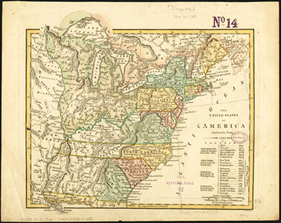
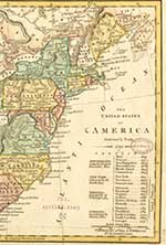
The Shape of the New Nation

This map was published in 1812, and shows the boundaries of each state and territory in the United States of America new nation at the time of independence.

American and British peace negotiators used a 1755 map by John Mitchell to delineate the border between the United States and Canada. Although drawn in 1755, the Mitchell map was considered the most detailed map of North American for most of the 18th century.


KEy Images on the
Wall

James Madison
Marquis de Lafayette
Thomas Jefferson
Sketch of the Maryland State House
The United States of America, Confirmed by Treaty 1783
Peace Commissioners

Key Documents on the Wall

Willianm Paca Proclamation
Announcing the Peace
Treaty of Paris

Exhibits in the Stairwell Room

John Shaw # 1 Des