
View Maryland Counties
- Allegany
- Anne Arundel
- Baltimore City
- Baltimore County
- Calvert
- Caroline
- Carroll
- Cecil
- Charles
- Dorchester
- Frederick
- Garrett
- Harford
- Howard
- Kent
- Montgomery
- Prince George's
- Queen Anne's
- St. Mary's
- Somerset
- Talbot
- Washington
- Wicomico
- Worcester
Cecil County
 Cecil County is the most northern of the Eastern Shore counties, forming the northeast corner of the state. It is bordered to the north by Pennsylvania, to the east by Delaware, the south and southwest by the Sassafras River and the Chesapeake Bay, and the west by Harford County. The county was formed in 1674 from Baltimore and Kent counties by a proclamation of the Governor. The county was named for Cecilius Calvert, Second Lord Baltimore and founder of the Maryland colony.
In the early eighteenth century, the rolling land of Cecil County was tobacco country, but by the time of the Revolution most farmers had converted to cash grain crops. Today, the economy is diversified even more with the addition of dairy and beef cattle and hogs. Along the waterfront, fishing and small boat industries are still important activities. Among Cecil County's famous natives is Augustine Herman, Maryland's first naturalized citizen, who in return for a grant of land from the Calverts, spent ten years surveying the shorelines and other boundaries to compile a map of Maryland and Virginia. Herman's map not only proved important to the Calverts in maintaining the boundaries of their grant, but was still referred to as late as 1873 in Maryland's border controversies with Virginia. The county was also home for two Maryland governors, Thomas W. Veazy and Austin Crothers, who served from 1836-1839 and 1908-1912 respectively.
Sights popular with visitors include the Chesapeake and Delaware Canal, a vital link in coastal transportation between Baltimore and Philadelphia; Mt. Harmon Plantation, an eighteenth century tobacco plantation on the Sassafras River; and Gilpin's Falls covered bridge, the longest covered bridge still standing in the state.
MSA SC 1477-5799
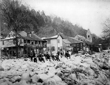
Before the construction of the Conowingo Dam in 1927, the Susquehanna River would regularly be backed up by enormous ice gorges like this one in Port Deposit c. 1904.
MSA SC 1477-6430
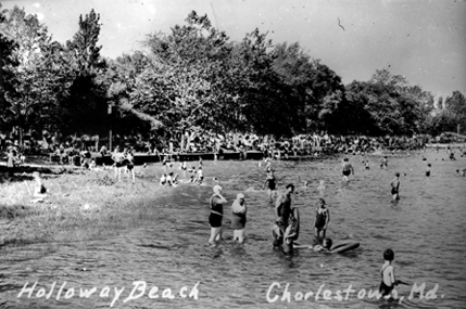
Charlestown was the seat of Cecil County until the courthouse was moved to Elkton in 1786. Located on the Northeast River at the head of the Chesapeake Bay, it was the site of several popular beaches, including Holloway's, pictured here c. 1940.
MSA SC 1477-6408
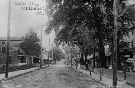
North East, Maryland was once a shipping point with regular boat service to Baltimore. At the time this photograph was taken c. 1910, both residences and businesses were located on the town's Main Street.
MSA SC 1477-5791
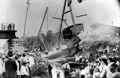
It was quite an event when the railroad bridge over Principio Creek collapsed on the Philadelphia, Baltimore and Washington line in 1904.
MSA SC 1477-5811
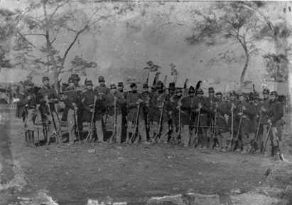
Elkton, the seat of Cecil County, was the hometown of Company I of the Fifth Maryland Volunteers, pictured in this tintype taken in 1862.