Charts and Maps Used by the Early Settlers of Maryland
Introduction
Examples from Edward C. Papenfuse and Joseph M. Coale III, The Maryland State Archives Atlas of Historical Maps of Maryland 1608-1908. Baltimore: The Johns Hopkins University Press, 2003:
Note that the early charts and maps of Maryland have West at the top of instead of North. That is because they were meant to be used to explain how Maryland was approached from the ocean. Full size prints of these maps are available from the Maryland State Archives, 350 Rowe Boulevard, Annapolis, Maryland., 21401.
While no one knows what charts the captains of the Ark and
the Dove followed on their voyages to the Chesapeake, it is
likely they consulted a rutter and English editions of Dutch
charts. As the Rutter Associates point out at
https://www.rutterassociates.com
A "rutter" is the name of the pilot book or seaman's guide carried by early (i.e., middle ages) navigators. The word "rutter" is likely derived from the French word "routier," meaning "something that finds a way." Italian Precursors to modern navigation charts, rutters contained written sailing directions between ports and indicated prominent costal landmarks and navigational hazards. The earliest rutters are thought to have appeared at the beginning of the fourteenth century, likely originating in Genoa.Continually updated and revised, rutters represented the best knowledge at the time about the way to get safely from one place to another and were the navigator's most prized possession.
The likely contemporary candidates for charts used by the pilots of the Ark and Dove are crude at best, as were the sailing instructions of the day.
An illustrated sample of the early maps that may have
been used by 17th century mariners is the on line
exhibit of the Geography Department of the University of
Alabama:
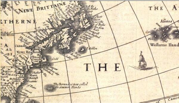
Detail from America, from John Speed's A Prospect of the Most Famous Parts of the World, 1631
The New York Public Library provides a good overview of charting at http://www.nypl.org/research/chss/epo/mapexhib/exhibit.html :
NAVIGATION AND ENGLISH CHARTINGThe earliest nautical sailing directions were oral instructions passed from pilot to pilot (a specialist in local waters, who guides visiting boats through them). These instructions developed into written descriptions of coastal navigation [rutters], from which evolved beautiful portolan charts, painted and drawn on vellum. In 1584-85, Lucas Waghenaer pulled this tradition together in the text, views, and hydrographic charts of his Spieghel der Zeevaerdt.
Translated into English in 1588, The Mariner's Mirrour was the model for much of the nautical mapping and charting …
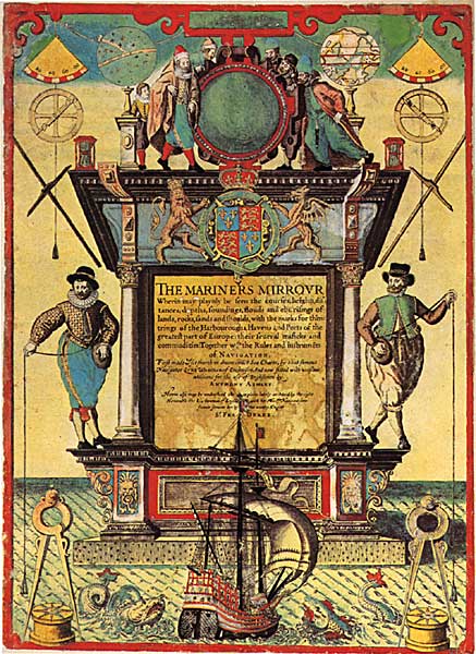
A map dealer summarizes the family of charts most likely
used by navigators including the pilots of the Ark and Dove
HONDIUS FAMILYThe Hondius Family is among the most important names associated with what has become known as the Dutch Golden Age of Cartography. The family business was founded by Jodocus Hondius I (1563-1612) and after his death was carried on by his two sons, Jodocus Hondius II and Hendrik Hondius. Jodocus was born in Wakken, the son of Olivier de Hondt, sheriff and registrar of Wakken and Petronella d'Havertuyn. His family moved to Ghent when Jodocus was still very young and by the age of eight he had taken up drawing and engraving. In 1584, because of the war with Spain and to escape religious persecution, Jodocus fled to London with his sister Jacomina, who was also an engraver. Shortly thereafter Jacomina married the Flemish émigré Pieter van de Berghe, and Jodocus married Coletta van den Keere, sister of Pieter van den Keere. These family alliances led to Hondius' introduction to the leading scientists and geographers of the day and laid the ground work for the remainder of his illustrious career. In 1588, he completed the engravings for the English edition of Lucas Waghenaer's Spieghel der zeevaart (The Mariner's Mirrour), one of the most elaborately engraved atlases of the 16th century. He then trained with the English cartographers Richard Hakluyt and Edward Wright, and soon gained an international reputation. In 1593 he returned to Amsterdam and established a business specializing in map and globe making. In 1604 Jodocus bought the plates of Mercator's Atlas, which had fallen behind in competition with Ortelius' popular atlas. He combined Mercator's original maps with about 40 of his own more up-to-date maps and from 1606 published enlarged editions of the Atlas, still under Mercator's name but with his own name as publisher. These atlases have become known as the Mercator/Hondius series, with nearly 50 editions published between 1606 and1641 in several different languages. Due to the immense popularity of the Atlas, the maps were re-engraved in miniature form and issued as a pocket Atlas Minor. Between 1605 and 1610 he engraved the plates for the maps in John Speed's The Theatre of the Empire of Great Britaine. Shortly before Jodocus' death in 1612, his daughter Elisabeth married another prominent publisher, Jan Jansson. The family firm continued to prosper, managed first by Coletta, then by Hendrik and Jodocus II, and finally passing on to Jansson. From 1632 the premises were known as De Wackeren Hondt.
The better images which are linked to the thumbnails below can be viewed with any jpg viewer in any browser, although IE will not permit the use of an external viewer and makes the viewing of jpgs very difficult. We recommend using Netscape and a free third party viewer called IRFAN
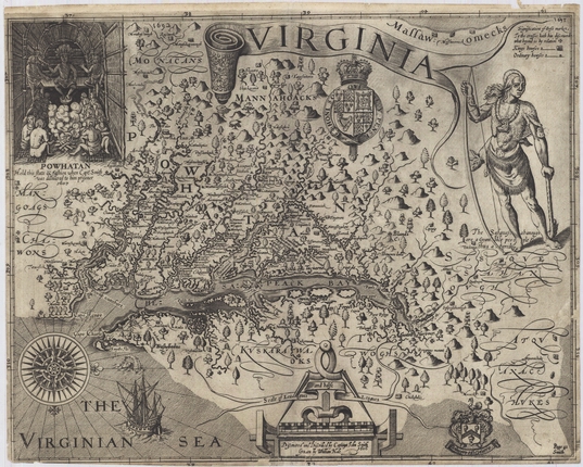
Figure 1. John Smith, Virginia, 1612 [1624, 9th State], Huntingfield Collection, MSA SC 1399-1-101.
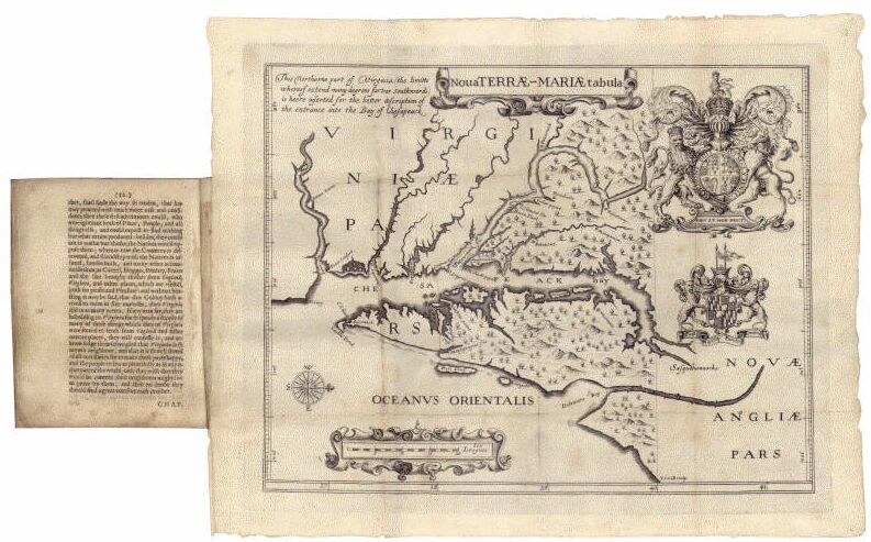
Figure 7. [Jerome Hawley and John Lewger]. Nova Terrae-Mariae tabula, 1635. Huntingfield Collection, Maryland State Archives. MSA SC 1399-1-526.
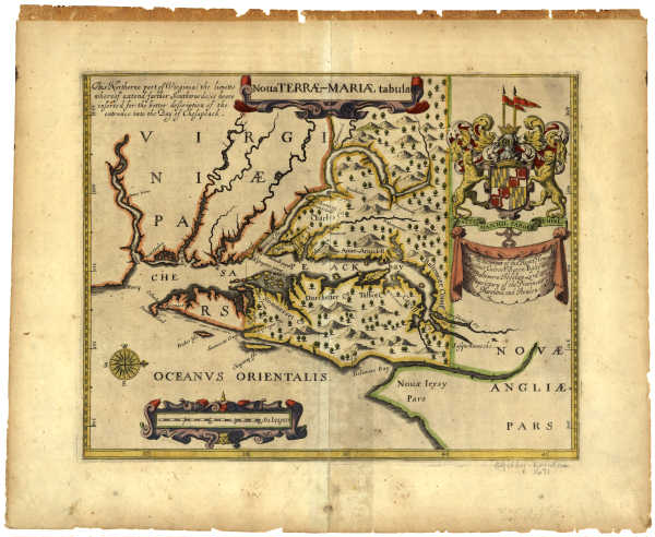
Figure 8. John Ogilby, Nova Terrae-Mariae tabula, 1671. Huntingfield Collection, Maryland State Archives, MSA SC 1399-1-187.

Figure 11. George Alsop, A land-Skip of the Province of Mary land, 1666 [1869], in Gowan's Bibliotheca Americana, MSA SC 1213-1-435.

Figure 18. Augustine Herrman,Virginia and Maryland, 1670 [1673]. Library of Congress, MSA SC 5339-1-172.
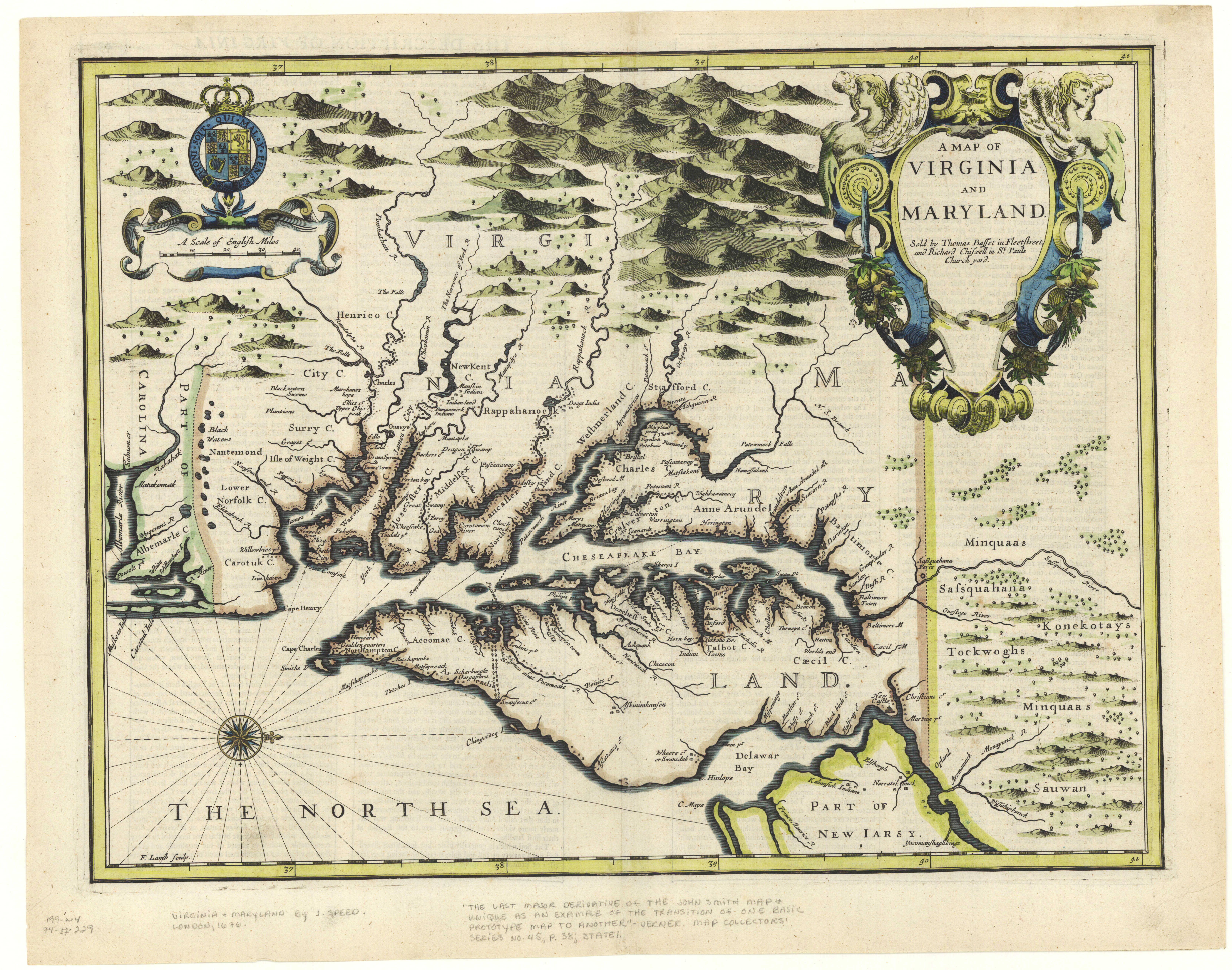
Figure 19a. Francis Lamb, Virginia and Maryland, in The Theatre of the Empire of Great Britain, 1676. Huntingfield Collection, MSA SC 1399-1-197.
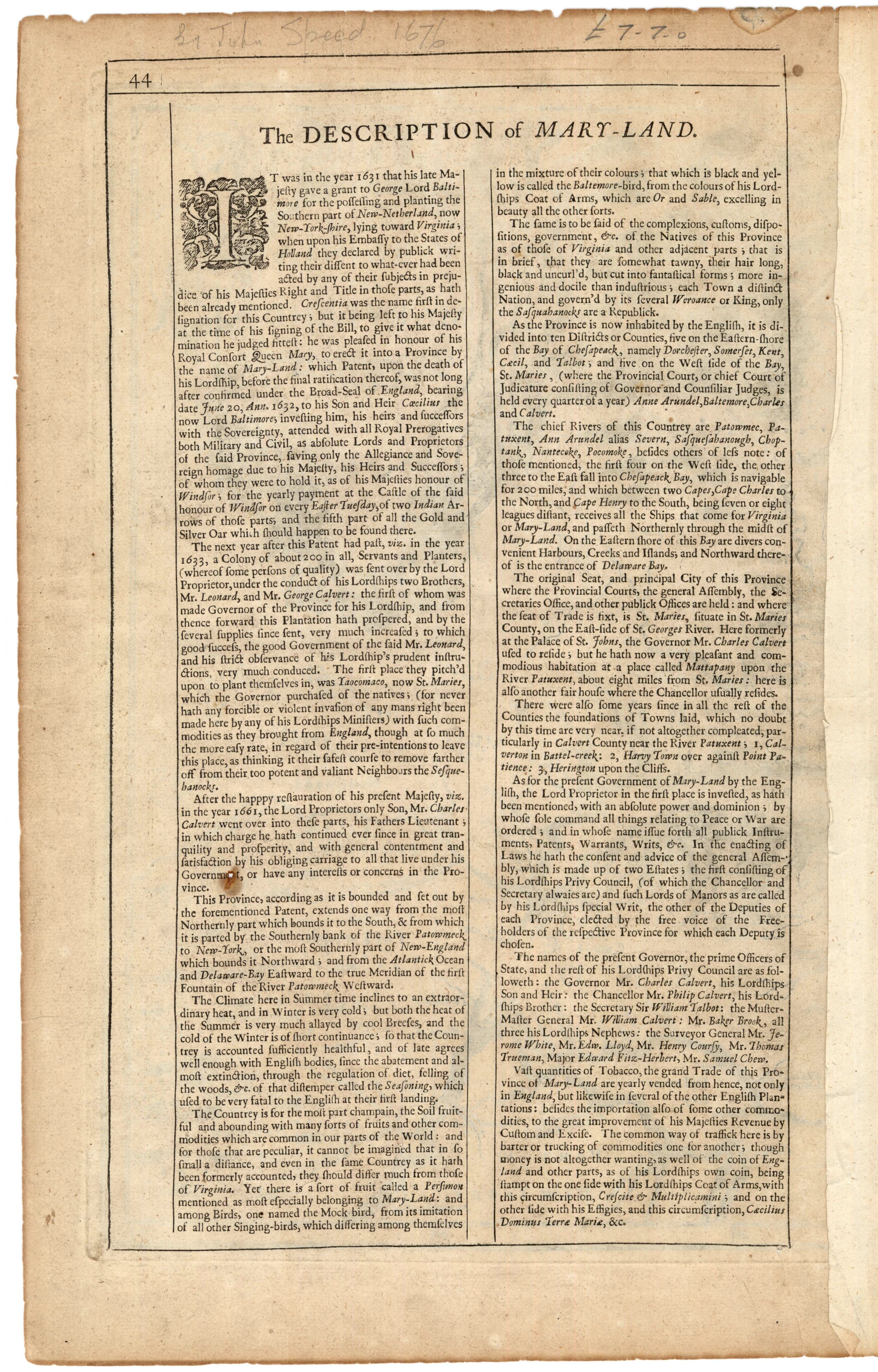
Figure 19b. John Speed, [Descriptions of Virginia and Mary-land], in The Theatre of the Empire of Great Britain, 1676, WilliamT. Snyder Collection, MSA SC 2111-1-3.
|
This web site is presented for reference purposes under the doctrine of fair use. When this material is used, in whole or in part, proper citation and credit must be attributed to the Maryland State Archives. PLEASE NOTE: The site may contain material from other sources which may be under copyright. Rights assessment, and full originating source citation, is the responsibility of the user. |
© Copyright December 15, 2023 Maryland State Archives
