|
[Next page is an image: Map showing the Lines of Equal Magnetic Declination for Maryland in the years 1700 and 1800]
494 FIRST REPORT UPON MAGNETIC WORK
ping out of the work of the present year. It will be interesting to
trace the further progress of the line of equal magnetic inclination 71°.
Special stress is to be laid this year upon the investigation of the
regional disturbances.
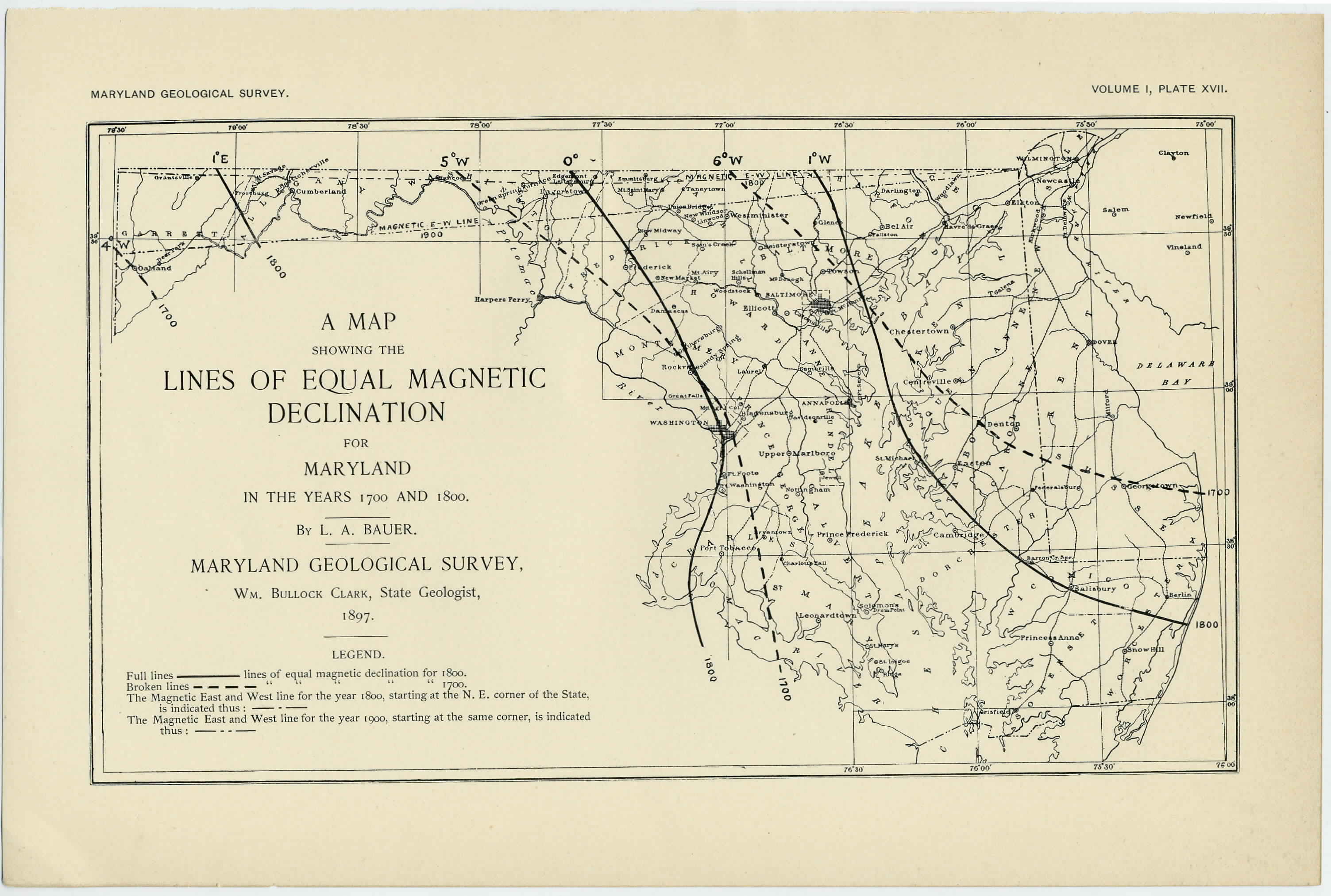
It will be noticed that at present the declination is westerly over the
entire area of the state, ranging from a little over 6° west in the
northeast to about 3 1/2° in the extreme west. The distribution of the
declination has, however, not always been thus.
ISOGONIC CHARTS FOR 1700 AND FOR 1800.
[Plate XVII.]
With the aid of the table, XII, giving the approximate values
of the magnetic decimation at the various county-seats from 1700 to
1900, and with the aid of the long series of observations in the
adjoining states, I have been able to construct isogonic charts for 1700
and for 1800 with a fair degree of accuracy. It will be seen that for
1700 the lines of equal magnetic declination are about the same as
those for 1900. In other words, in the first decade, approximately, of
the eighteenth century the needle pointed in precisely the same direc-
tion as at present. But this did not occur simultaneously over the
entire state; hence the isogonic chart, while closely approximating the
1900 chart, would not be exactly the same.
The lines for 1800, however, present a vastly different appearance.
We now have a central line—the so-called agonic line (line of no
declination)—along which the needle was " true to -the pole." East
of this line the needle bore by a small amount west of true north,
while west of the line the needle pointed east of true north.
THE SECULAR MOTION OF THE AGONIC LINE OVER MARYLAND.
When did the line of no declination enter the state and when did
it. leave it? Was its position in 1800 the extreme easterly one?
These are questions that we can again answer with the aid of the
table XII. Turning back to it we obtain the following facts:
|
|
|
|
|
|
|
|
|
|
Lati-
|
Longi-
|
Needle true to pole
|
|
|
|
|
tude.
|
tude.
|
approximately in
|
|
|
|
Oakland.........
|
39.4
|
78.4
|
1769 and 1850
|
|
|
|
Cumberland
|
39.6
|
78.8
|
1781 1836
|
|
|
|
Hagerstown
|
39.6
|
77.7
|
1793 1828
|
|
|
|
Frederick ......
|
39.4
|
77.4
|
1797 1820
|
|
|
|
Washington
|
38.9
|
77.0
|
1790 1810
|
|
|
|
|
|
|
|
|
|