|
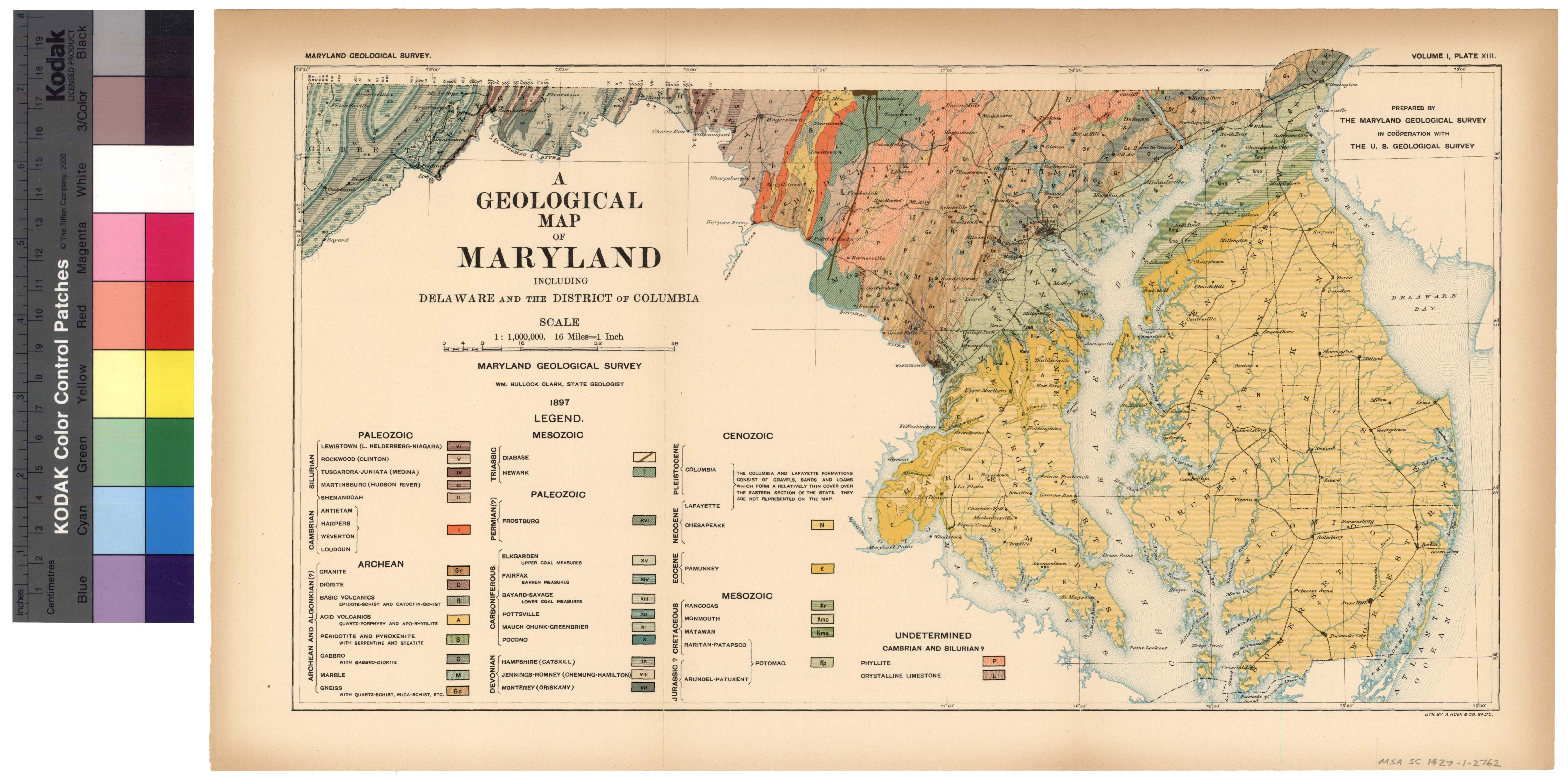
[Next page is an image: Geological Map of Maryland]
204 PHYSIOGRAPHY, GEOLOGY AND MINERAL RESOURCES
time. During this period of upper Cretaceous submergence the land
of the continent must have stood at a low level, since the sediments
accumulated slowly and with a constantly decreasing quantity of land-
derived materials.
At the close of Mesozoic time, or perhaps a little later, another ele-
vation of the continent, accompanied by the gradual stripping off of
the deposits of earlier date, took place. Over this irregular surface
the Eocene deposits were laid down in the submergence which opened
the Tertiary period. Again came elevation at the close of the Eocene,
followed by another submergence during the early Neocene, although
the transgression of the previous period, which had gradually over-
lapped the Cretaceous deposits to the southward, was now towards the
north, so that the oscillations of the continent in Tertiary time were
much less normal to the coastal border than they had been during the
late Cretaceous. During the early Neocene period a great volume of
sediments was deposited, the strata giving evidence of a large dis-
charge of land-derived materials from the adjacent continent. The
elevation at the close of this epoch was followed by a brief submerg-
ence in the late Neocene period, during which the sea encroached
considerably upon the Piedmont Plateau, while during the elevation
which followed this brief period of submergence the present topo-
graphy of our Coast border region was largely carved out. It was
then that the great valley of the Chesapeake Bay with its estuaries
was formed and the drainage of the area reached the existing ocean
through capes Charles and Henry. A further depression in early
Pleistocene time submerged the valley together with the low country,
and choked with sediment the former drainage lines. This submerg-
ence, however, was not sufficiently long continued to entirely oblit-
erate the old channels, for in later Pleistocene time another elevation
removed the water from the higher portions of the valleys, and,
although there was a brief subsequent submergence with accompany-
ing elevation, the main confines of the valleys can to-day be seen with
their lower courses still occupied, as in the case of the Chesapeake
Bay and its major tributaries, by tidal waters.
|
 |