|
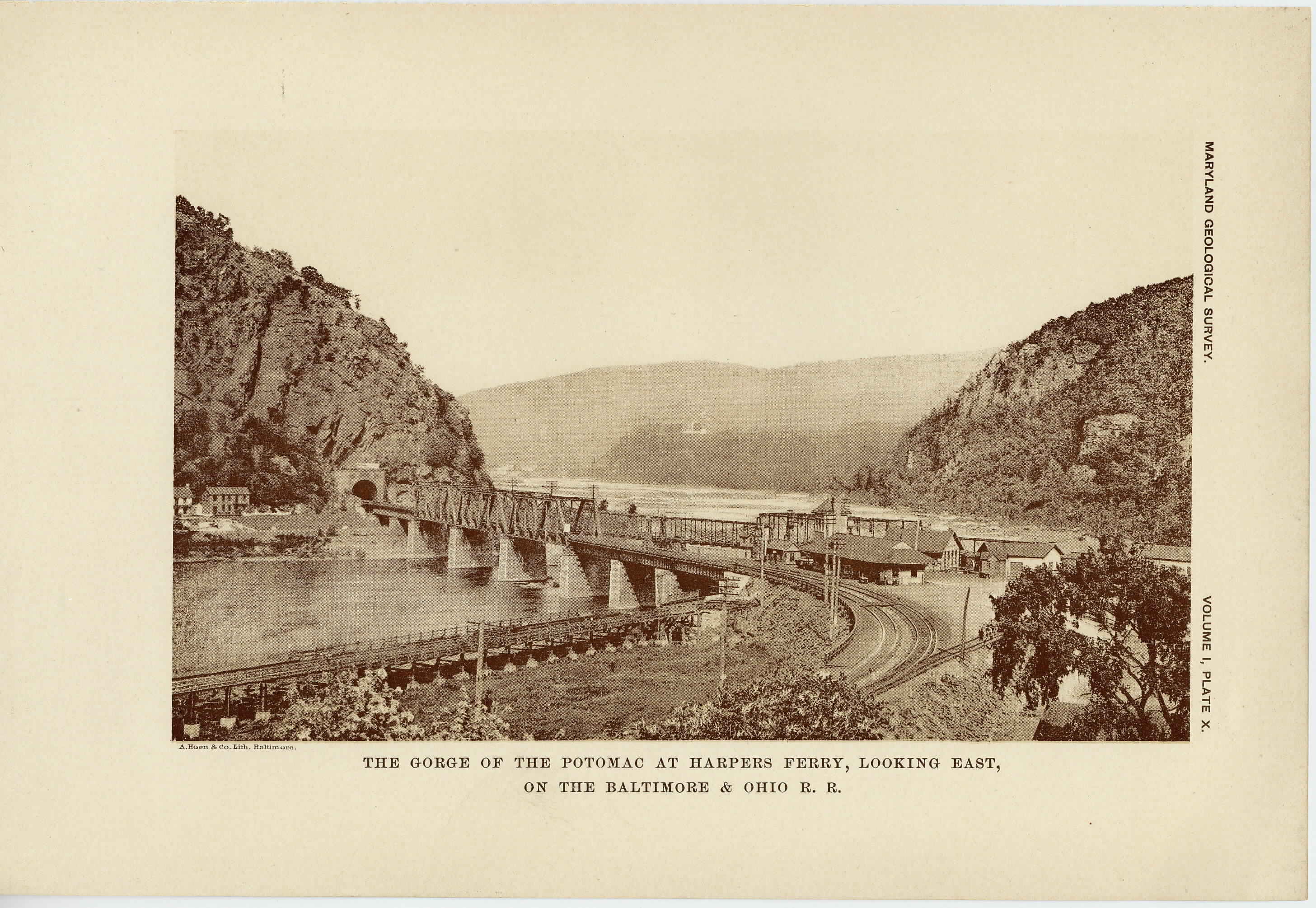
[Preceding page is an image: The Gorge of the Potomac at Harper's Ferry looking east, on the Baltimore and Ohio Railroad]
MARYLAND GEOLOGICAL SURVEY 177
slate with limestones, shales, sandstones and conglomerates. The
coarser and thicker deposits are found in narrow synclines upon the
surface of the Algonkian rocks; the thinner and finer beds are in the
synclines, which are succeeded by the Weverton sandstone. The lime-
stones occur in the form of lenses in the slate and are best developed
along the eastern side of the district just to the west of the Catoctin
Mountain, where they are generally highly metamorphosed. Beds
of sandstone occur in the Loudoun formation, although more promi-
nently developed to the south of the Potomac river. The thickness
of the formation is very variable, ranging from a few to over 500 feet.
The formation as a whole has been much metamorphosed, alteration
being most apparent in the argillaceous beds, which have been changed
into slates and schists, all traces of the original bedding being fre-
quently lost. The slate readily decomposes, forming low ground, but
the more silicious rocks commonly occur as small hills or ridges.
THE WEVERTON FORMATION. The Weverton formation, so called
from its occurrence near Weverton at the point where the Blue Ridge
reaches the Potomac river, consists of massive beds of fine, pure sand-
stone, quartzite, anl conglomerate. They are usually white, the
coarser beds somewhat gray. In the Blue Ridge the sandstones are
streaked with black and bluish bands. The deposits are mainly com-
posed of quartz grains, which are well worn and are washed quite
clean of fine argillaceous materials. They at times show cross-bed-
ding, which indicates that the formation was largely laid down in
shallow water. The thickness of the formation is quite variable, be-
tween 200 and 300 feet.
The Weverton sandstone has been subjected to but little meta-
morphism, as the quartz particles which comprise the deposits do not
afford materials which admit of much alteration. Slight schistosity
is evident in the southern part of the Catoctin Mountain. The sand-
stone decays slowly and generally forms projecting ledges on the sur-
face of the country.
THE HARPERS FORMATION. —The Harpers formation, so called
from its typical occurrence at Harper's Ferry, is composed largely of
sandy shales with a few sandstone layers imbedded in its upper por-
|
 |