|
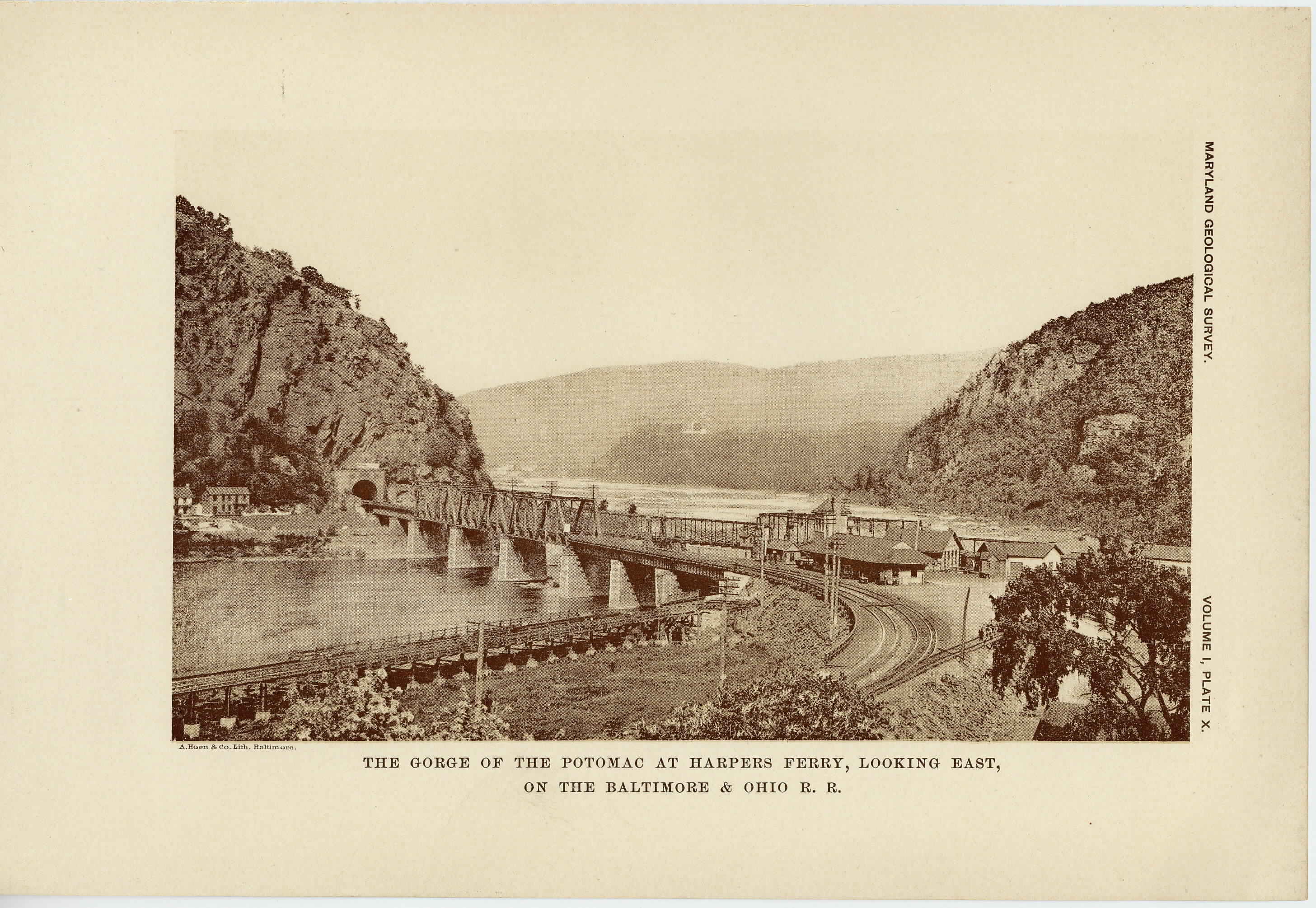
[Next page is an image: The Gorge of the Potomac at Harper's Ferry looking east, on the Baltimore and Ohio Railroad]
176 PHYSIOGRAPHY, GEOLOGY AND MINERAL RESOURCES
yard to six miles, with an average of perhaps 100 yards. The areal
distribution in Maryland is confined to the low land north of the
Potomac river, between the Blue Ridge and Catoctin mountains. No
evidence is at hand to show the relation between this mass of granite
and those already described from northeastern Maryland. It seems
probable, however, that they are of the same age and origin. The
small tongues of granite running out into the schistose basic rocks
indicate that the former is the younger and that it has been intruded
into the latter. The granites show only a moderate amount of mica
and are frequently garnet or epidote-bearing, the garnet-bearing type
being well exposed along the Potomac a mile or so east of Harper's
Ferry. Here, as in the rest of the area, the granites show marked
evidence of dynamic metamorphism. The feldspars have been de-
formed and altered, first along the cracks and then finally entirely into
lenticles of quartz, muscovite and chlorite. This final stage is
macroscopically nothing more than a silicious slate or schist and is
barely distinguishable from the end products of similar metamorphism
in the more feldspathic schists and the Loudoun sandy slates.
THE CAMBRIAN PERIOD.
The rocks of the Cambrian are confined to the eastern division of
the Appalachian Region, previously described as comprising the Blue
Ridge and Great Valley, and cover considerable areas in Frederick
and Washington counties. They consist of sedimentary materials
that have been much metamorphosed since they were deposited, and
also subjected to marked structural disturbances, rendering their rela-
tions at times difficult of interpretation. Five divisions have been
recognized in the sequence of Cambrian deposits, known respectively
as the Loudoun, Weverton, Harpers, Antietam and Shenandoah for-
mations, the latter, however, being also in part of lower Silurian age.
THE LOUDOUN FORMATION. —The Loudoun formation, so called
from its typical development in Loudoun county, Virginia, is repre-
sented in Maryland in long narrow belts of rock accompanying the
mountain ridges, and is found in the Catoctin Mountain, the Blue
Ridge and the Elk Ridge. The deposits consist largely of a fine dark
|
 |