|
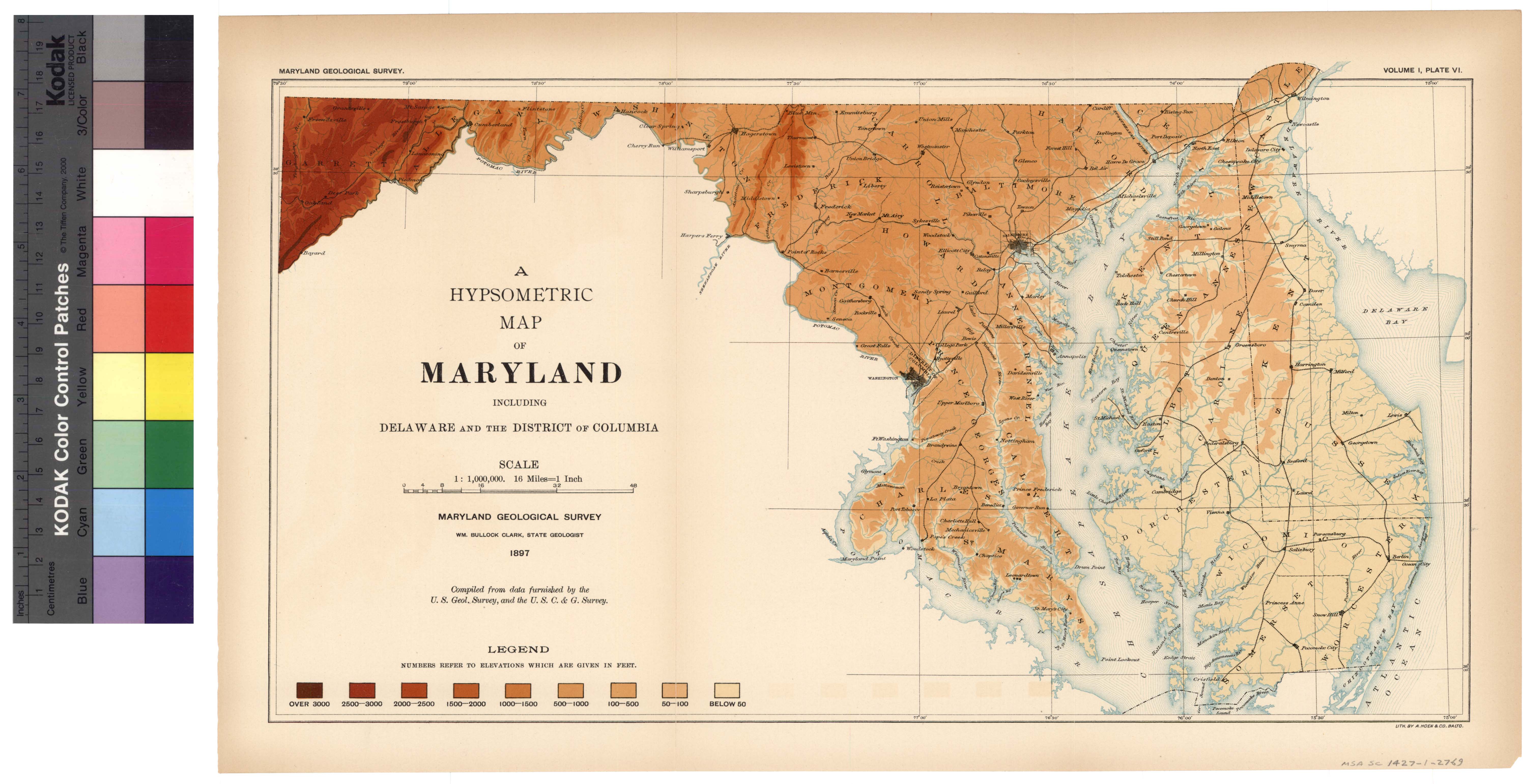
[preceding page is an image: Hypsometric Map of Maryland]
MARYLAND GEOLOGICAL SURVEY 143
In the succeeding pages the Physical Features of Maryland will be
considered under the three following headings, viz., Physiography,
Geology, and Mineral Resources.
PHYSIOGRAPHY.
The state of Maryland in its physiographic features is closely
related to the states which lie to the north and south of it. It is
part of the eastern border region which stretches from the Atlantic
coast-line to the crest of the Alleghanies and from its central situa-
tion affords, perhaps, the most characteristic section of this broad
belt. The country rises from the sea level at first gradually and then
more rapidly until it culminates in the high lands of the western
portion of the state. It has been divided throughout the middle
Atlantic slope into three physiographic areas known respectively as
the Coastal Plain, the Piedmont Plateau and the Appalachian Region.
Before taking up the more detailed description of the Maryland area
a brief characterization of the three leading physiographic divisions
will be given.
The Coastal Plain as a continuous tract begins in New Jersey on
the south shore of the Raritan Bay, where it has a width of from
fifteen to twenty miles, and extends thence southward, constantly
broadening, until in Georgia it reaches nearly one hundred and fifty
miles. North of New Jersey it is continued in the islands along the
New England coast (the largest being Long Island, Martha's Vine-
yard and Nantucket) as well as in the narrow strip of main land
which forms the southeastern portion of the state of Massachusetts.
The Coastal Plain is characterized by broad, level stretches of slight
elevation, which are cut by the larger rivers that flow across the area
from the Piedmont Plateau, and the smaller streams that have their
sources within the low land itself. Most of the streams have slug-
gish currents and the drainage of the land is imperfect. Through-
out, the country is deeply indented with tidal estuaries and bays, the
heads of which commonly reach quite to the border of the Piedmont
|
 |