|
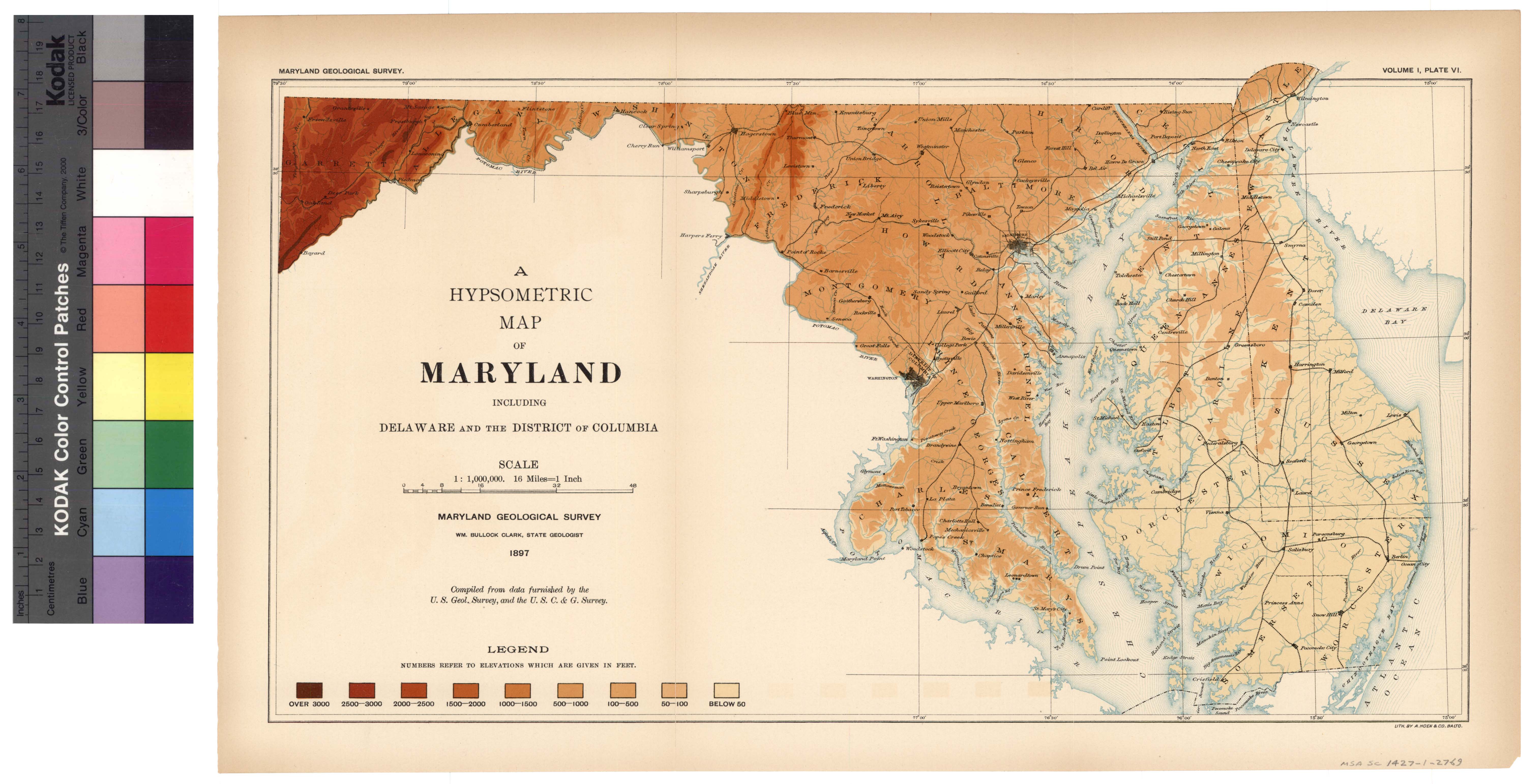
[Next page is an image: Hypsometric Map of Maryland]
142 PHYSIOGRAPHY, GEOLOGY AND MINERAL RESOURCES
state is 12, 210 square miles, of which 9860 square miles are land
surface; the included portions of Chesapeake Bay, 1203 square miles;
Chincoteague Bay on the Atlantic coast, 93 square miles, and 1054
square miles of smaller estuaries and rivers.
Maryland is divided into twenty-three counties, of which Garrett,
Allegany and Washington form the mountainous region known as
Western Maryland; Frederick, Carroll, Baltimore, Harford, Cecil,
Howard and Montgomery the Piedmont area, which is also referred
to under the name of Northern-Central Maryland; Anne Arundel,
Prince George's, Calvert, Charles and St. Mary's, commonly called
Southern Maryland; and Kent, Queen Anne's, Talbot, Caroline, Dor-
chester, Wicomico, Somerset and Worcester, known as Eastern Mary-
land. Of these twenty-three counties there are but seven that do not
lie upon navigable waters.
The physical features of a country to no inconsiderable degree
determine the pursuits of its inhabitants, and these indirectly affect
their social, political and financial welfare. The residents of
mountainous districts have their peculiar occupations, while those of
the low lands find their employment in other ways. In regions
bordering the sea or inland bodies of water still other means of liveli-
hood are sought by the people. The character of the soil and its
adaptability to particular crops become also important factors, while
the underlying rocks, not only by their influence upon the conditions
of life already described, but also by their inherent wealth in mineral
resources, still further influence the well-being of the community.
It becomes important, therefore, to know something of the physical
features of a country, or a state, if one would understand its past
history or indicate the lines of future prosperity.
When we come to examine the physical features of the state of
Maryland we find the greatest diversity in surface configuration and
mineral contents. From its eastern to its western borders may be
found a succession of districts suitable from their physical surround-
ings for the most diverse employments. Maryland possesses portions
of all the characteristic divisions of the eastern United States, and
there is no state in the country which has a greater variety in its
natural, surroundings.
|
 |