|
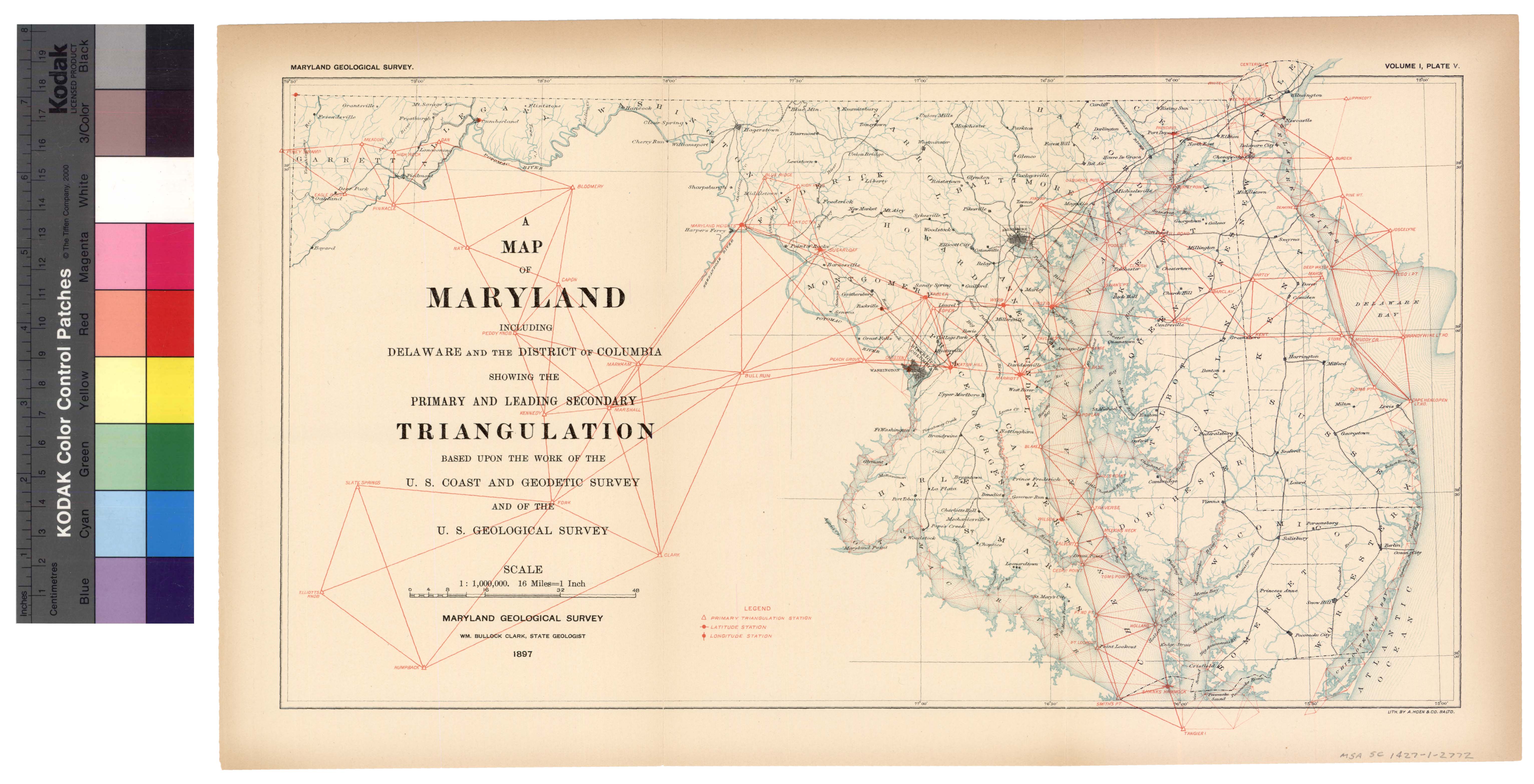
[The preceding page is an image: Map showing leading Triangulation in Maryland
]
MARYLAND GEOLOGICAL SURVEY 123
SURVEY OF SPARROWS' POINT, 1891. —In May, 1891, a closely de-
tailed topographical survey of the locality of the works of the Mary-
land Steel Company at Sparrows' Point, Patapsco river, and the hydro-
graphic survey of its water-front to the Baltimore ship channel, and
Bear creek to the railroad bridge, were made by Assistant J. W. Donn.
SURVEYS OF OTHER PORTIONS OF MARYLAND AND ADJACENT TERRITORY.
The following report shows in a partly tabulated form the work of
the Coast Survey in other portions of the state of Maryland and the
District of Columbia between the years 1832 and 1896.
TRIANGULATION. —In 1844-45-46 the primary triangulation was
carried across from the Delaware Bay to the head of the Chesapeake
and down to the Kent island base-line, established during this period
by Assistant Edward Blunt and James Ferguson. In the latter year
the work was extended to the District of Columbia, and in 1847 had
reached Point No Point and Hooper's island. In 1848 the entrance
of the Potomac river was included in the lines.
The secondary triangulation progressed with the primary, but in-
cidental to topographic work was continued over the Chesapeake and
its Maryland tributaries during the entire period closing with 1870.
Primary triangulation was begun in 1864-65 by Assistant J. A.
Sullivan, in western Maryland, as a part of the trans-continental
scheme. Afterward this was continued by Assistant C. O. Boutelle.
At the present time the stations Maryland Heights and Sugar Loaf
Mountains are connected with the work of Chesapeake Bay and the
work passing over western Virginia. The position of Rockville, Md.,
has also been determined as described by Assistant Edwin Smith, in
Bulletin No. 25.
The map shows the primary and secondary triangulation; the ter-
tiary work cannot well be put on, owing to the great detail, the number
of lines would be confusing.
The geographic positions in Maryland, determined by the United
States Coast and Geodetic Survey up to the end of 1896 number 1173.
Base-lines were measured at Kent island (primary), 1844; at Sine-
puxent Beach (secondary), 1853; at Port Tobacco (tertiary), 1862;
at Baltimore (secondary), 1886 and (tertiary) 1894.
|