|
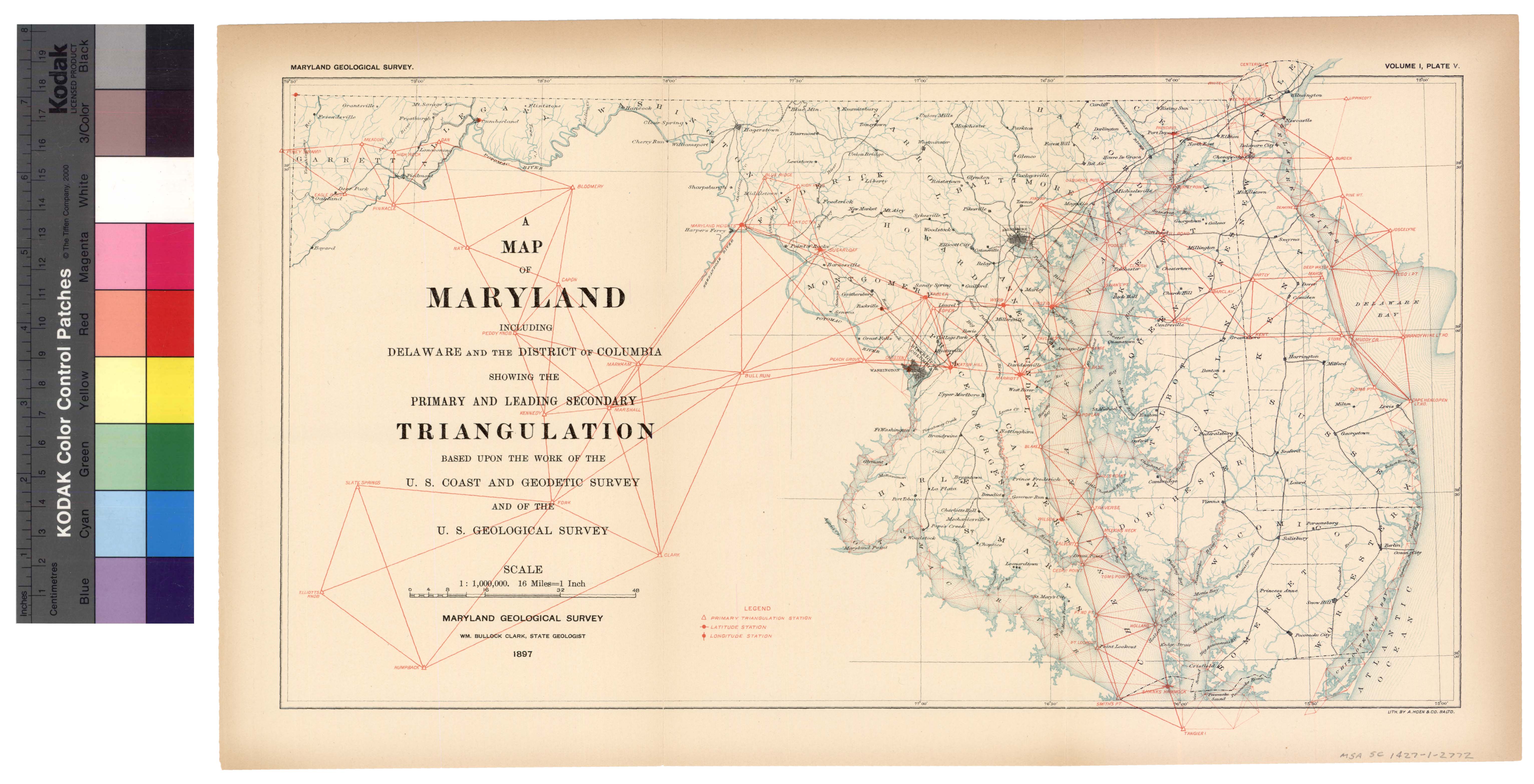
[The next page is an image: Map showing leading Triangulation in Maryland]
122 HISTORICAL SKETCH
walks of the city, except where no streets had been opened, as along
the middle branch of the Patapsco river, where the stones were set
along the high-water line. These stones were connected with the
triangulation and their location accurately described in the records.
As a base for the needful triangulation, Assistant Tittmann adopted
the same line, Bayview monument, that had been used in 1876, and
as the progress of the measurements between the reference stones in
the streets disclosed a want of accord between the distances determined
by these measurements and those deduced from the triangulation, it
was deemed advisable to strengthen and check the triangulation by
connecting it with some of the primary stations. Finally, however,
on account of the difficulties of recovering the stations proposed and
the expense attending their occupation, it was decided to obtain the
desired check by the measurement of a base line and its introduction
into the triangulation. A site about a mile in length having been
selected on Fort Avenue, the measurements were made with the four-
metre contact slide case apparatus and a correction found and applied
to the previously accepted distance, Bayview monument. One hun-
dred and seven geographical positions were determined, of which all
but eleven were new.
In the scheme of triangulation carried out by Assistant Tittmann,
many points of the work of 1876 were included. Of the one hun-
dred and eleven geographical positions determined, nearly all can be
identified and made available for future surveys. The prominent new
positions added to the previous lists are: " Grace Methodist Church
Spire, " " St. James' Church Spire, " " Johns Hopkins Hospital, "
" City Hall, " " Holy Cross Church Spire, " and the " Canton Ele-
vator. "
At the end of March, 1887, Major Hutton applied for the assign-
ment of an officer of the survey to execute certain work supplementary
to that accomplished by Assistant Tittmann, and Sub-Assistant W. I.
Vinal was assigned for that purpose. In connection with the sound-
ings made, some miscellaneous measurements, of streets and wharves
along the water front were included in his work.
|
 |