Vegetable Dish, Washington County
From the USS Maryland Silver Service
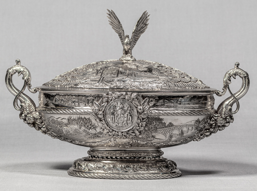
Maker: Samuel Kirk & Sons (1815-1979)
Object: Vegetable Dish (with Lid), Washington County
Date: 1906
Medium: Sterling Silver
Dimensions: Overall height, 8 5/8"; Overall width, 12 7/8"; Overall depth, 6”
Accession number: MSA SC 1545-0937-2
Talbot and Washington Counties are represented by covered vegetable dishes that depict historic events and sites from each county. Washington County was created from Frederick County in 1776, and was named for George Washington (1732-1799). It was the first Maryland county formed after the Declaration of Independence. The scenes on this piece showcase the westward expansion of Maryland.
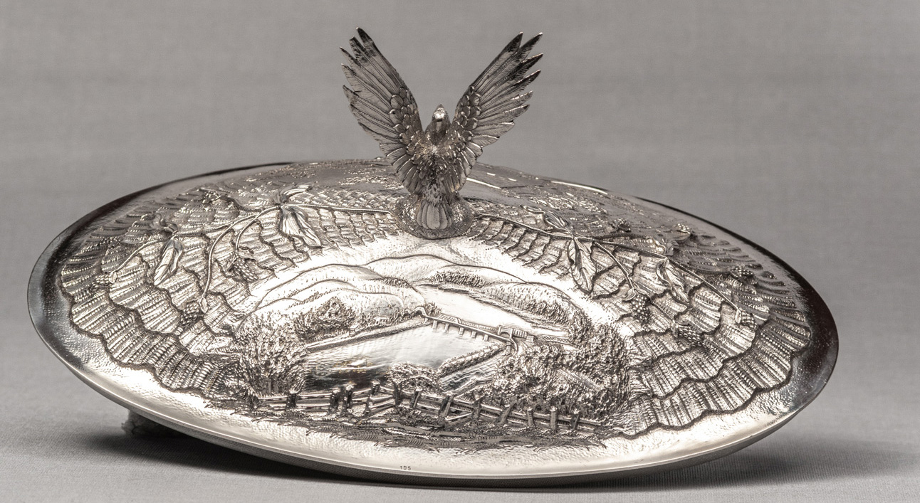
The Great Seal and the Cruiser are each surrounded by sprays of chestnut, pine and oak leaves, and inverted cornucopias form the handles of the dish. The upper portion of the dish is decorated by four scenes of 18th century landmarks in Washington County. A festoon of tobacco leaves separate each scene, while oyster shells form the border of the bowl. The engraved scenes on the top are separated by sprays of mulberry, and an eagle with upraised wings sits atop the lid.
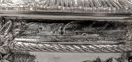
Scenes on dish (top to bottom, left to right):1. Chesapeake and Ohio Canal (number 103)
Today, the canal is used as a recreational trail managed by the National Park Service.
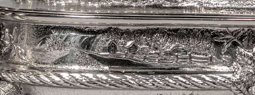
Fort Frederick was built in 1756 to protect Maryland’s western frontier during the French and Indian War. The fort was named in honor of Frederick Calvert, Sixth Lord Baltimore by Governor Horatio Sharpe. During the American Revolutionary War, it served as a prison for British Soldiers. In the Civil War, the fort was occupied by Union troops to guard the Chesapeake and Ohio Canal.
The state of Maryland acquired the property in 1922, making it the first state park. Today, visitors can see the fort's stone wall and two barracks which have been restored to their 1758 appearance.
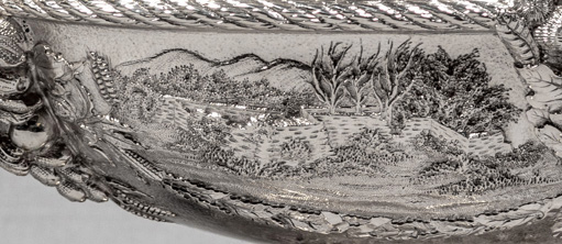
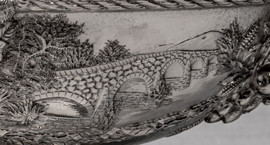
5. Bridge over the Conococheague River (number 98)
Wilson's Bridge was listed on the National Register of Historic Places in 1982 and restored in 1984. Today it is open to visitors who wish to walk across it.
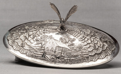
Scene on front of lid: (right to left)
1. Home of Captain Moses Chapline (number 106)
His log cabin depicted on the lid for the vegetable dish was a frequent resting place for Generals Washington, Bradock, Gates and Royal Governor Horatio Sharpe when they were traveling in the western part of the state.
Scenes on the reverse (top to bottom, left to right):
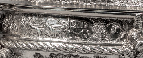
1. Stagecoach on Cumberland Road (number 101)
The use of stagecoaches was very popular along the National Road in Maryland, and they could be seen running all day and into the early evening.
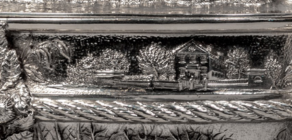
2. Hagerstown Bank (number 102)
3. Mumma Church, Antietam (number 99)
During the battle, the church was used to treat wounded Confederate troops and was later used as a hospital to treat both wounded Union and Confederate troops. President Lincoln is said to have visited the church a few weeks after that battle and greeted troops from both sides.
The Church was restored for the 100th anniversary of the battle in 1962 on the original foundation. It is part of the Antietam National Battlefield, managed by the National Park Service.
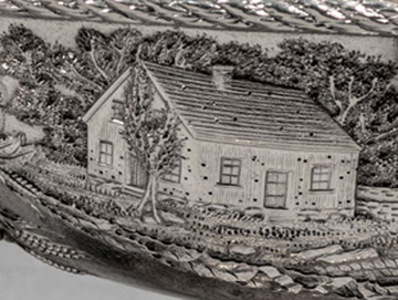
4. USS Maryland Cruiser
5. Jacob’s Lutheran Church (number 100)
The cornerstone of the church depicted on the vegetable dish was laid on September 10, 1841. In 1854, the church was enlarged by an addition about 16 feet in length and extensive repairs were again made in 1881.
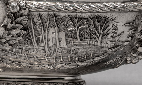
Scene on back of lid:
1. Harper’s Ferry (number 105)
|
This web site is presented for reference purposes under the doctrine of fair use. When this material is used, in whole or in part, proper citation and credit must be attributed to the Maryland State Archives. PLEASE NOTE: The site may contain material from other sources which may be under copyright. Rights assessment, and full originating source citation, is the responsibility of the user. |
© Copyright August 07, 2024 Maryland State Archives
