Vegetable Dish, Talbot County
From the USS Maryland Silver Service
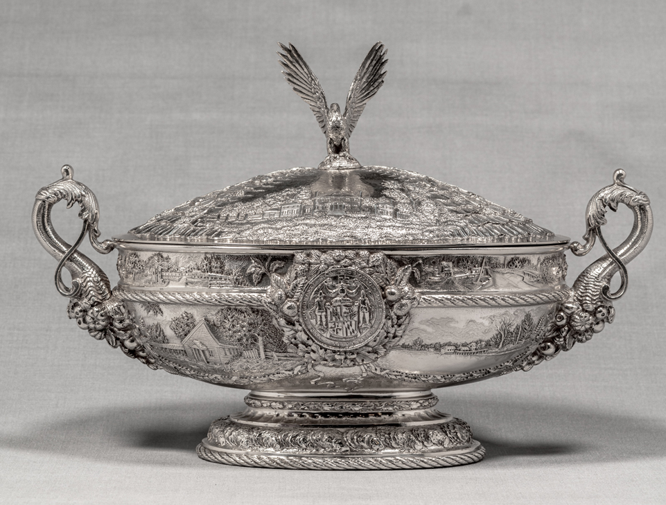
Maker: Samuel Kirk & Sons (1815-1979)
Object: Vegetable Dish (with Lid), Talbot County
Date: 1906
Medium: Sterling Silver
Dimensions: Overall height, 8 5/8"; Overall width, 12 7/8"; Overall depth, 6”
Accession number: MSA SC 1545-0937-1
Talbot and Washington Counties are represented by covered vegetable dishes that depict historic events and sites from each county. The formation of Talbot County is not known, but the county was in existence by February 18, 1661/ 62, when a writ was issued to the sheriff. The county was named after Lady Grace Talbot, sister of Cecilius Calvert, Second Lord Baltimore, and wife of Sir Robert Talbot, Irish statesman.
The Great Seal and the Cruiser are each surrounded by sprays of chestnut, pine and oak leaves, and inverted cornucopias form the handles of the dish. The upper portion of the dish is decorated by four scenes of historic landmarks in Talbot County. A festoon of tobacco leaves separate each scene, while oyster shells form the border of the bowl. The engraved scenes on the top are separated by sprays of mulberry, and an eagle with upraised wings sits atop the lid.
Scenes on dish (top to bottom, left to right)
:
1.
Wagon Bridge or Chesapeake and Delaware Canal (number 111)
On July 4, 1829, the Chesapeake and Delaware Canal opened connecting the Delaware River with the Chesapeake Bay. The total construction cost was $2,250,000. The original lock canal measured 13⅜ miles long, 10 feet deep and 66 feet wide. Sailing vessels drawing less than 9 feet could navigate the canal.
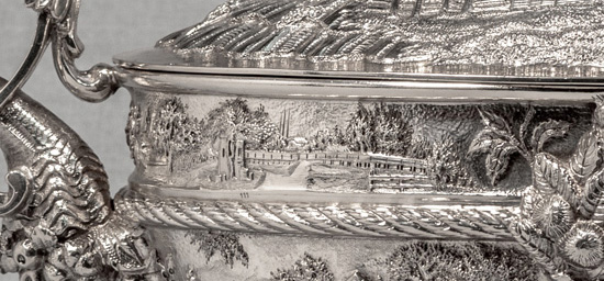 Wagon Bridge or Chesapeake and Delaware Canal
2. Maryland Pivot Bridge (number 112)
Pivot Bridge was a small village in Maryland very close to the Delaware state line. The Chesapeake and Delaware Canal divided the town of Bethel, so a pivot bridge was built over the waterway to reconnect the two sides of the town, after which it was renamed Pivot Bridge. The bridge ceased operation in 1925, and by 1960 the town was lost when the canal was expanded.
 Maryland Pivot Bridge
3.
Friends' Meeting House (number 107)
Governor
Leonard Calvert granted the Quakers land on the Eastern Shore after they were expelled from the colony of Virginia in 1660. They settled in the area of present day Easton.
The meeting house depicted on the vegetable dish was completed in 1684. The Third Haven Meeting House is widely considered the oldest meetinghouse of the Religious Society of Friends, and services are still held there. The church’s records from 1676 to the present are on deposit at the Maryland State Archives for safe keeping.
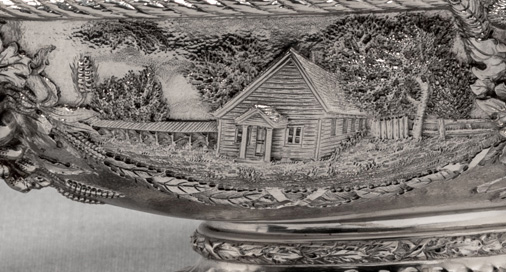 Friends' Meeting House
4. Great Seal of Maryland
5.
The Anchorage (number 108)
This historic Greek Revival five-part house depicted on the vegetable dish was built on the Miles River near Easton. Governor Edward Llyod bought the property in 1831 as a wedding present for his daughter, Sally Llyod Lowndes. In 1832, she expanded the existing house and named the property "The Anchorage" to honor her husband, Commodore Charles Llowndes, U.S.N.
The Anchorage was added to the National Register of Historic Places in 1974.
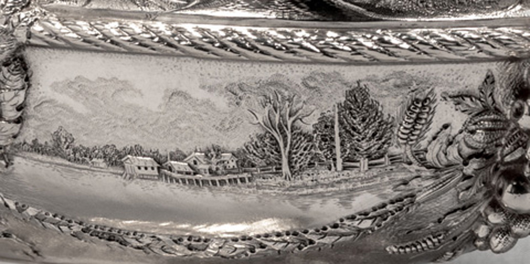 The Anchorage
Scene on front of lid:
1.
Graveyard at Wye House (number 116)
The image of the Llyod family cemetery is shown on the lid for the vegetable dish. The oldest headstone in this family graveyard dates to 1684 (Captain James Strong).
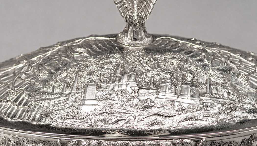 Graveyard at Wye House
Scenes on the reverse (top to bottom, left to right):
1.
Basin at Chesapeake City (number 114)
This scene depicts a view of the Chesapeake and Delaware Canal from the basin at Chesapeake City. Today, visitors see the Chesapeake City Bridge, built by The U.S. Army Corps in 1948-49, which is the most recent replacement of the original bridge that crossed the Canal depicted on the vegetable dish.
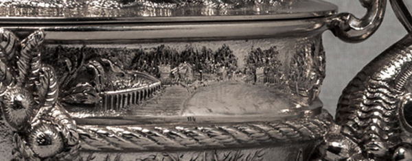 Basin at Chesapeake City
2.
View of Chesapeake City (number 113)
Chesapeake City was originally called Bohemian Manor by
Augustine Herman, the first naturalized citizen of Maryland. He was naturalized by order of
Cecil Calvert, Second Lord Baltimore for drawing the first accurate map of the Chesapeake Bay. Due to the economic boom and increased population from the Chesapeake and Delaware Canal, in 1839 the area became known as Chesapeake City.
 View of Chesapeake City
3.
Old Wye House (number 109)
The original residence of the famed Llyod family is depicted in this scene of the vegetable dish. It was built c. 1747 and was used as a captain's residence after the Llyod family finished building Wye House in 1784.
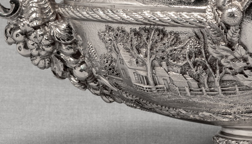 Old Wye House
4. USS
Maryland Cruiser
5.
St. John’s Church (number 110)
The ruins of St. John's Chapel of St. Michael's Parish are still standing today. The construction of the church was completed in 1835 and it was used until about 1900.
It was one of the first Gothic Revival churches on the Eastern Shore and was added to the National Register of Historic Places in 1974.
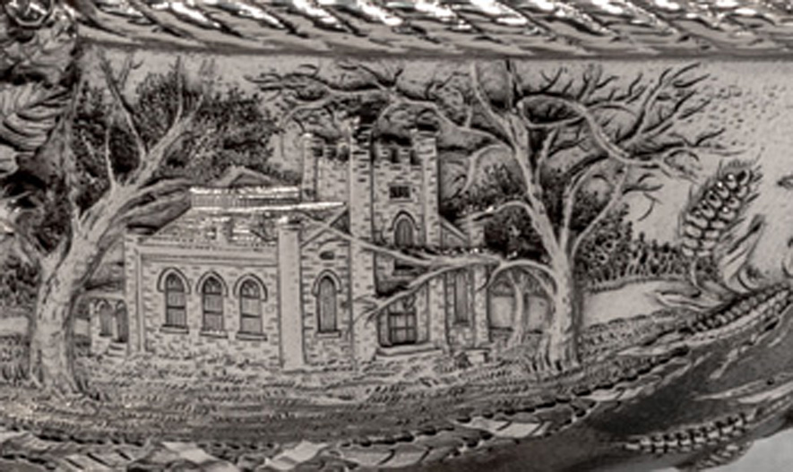 St. John’s Church
Scene on back of lid:
1.
Wye House (number 115)
The main part of Wye House was built between 1781-1784 by Edward Llyod IV and is considered one of the most famous plantations on Maryland’s Eastern Shore. It is a seven-part house in the Georgian and Federal styles and was designated a National Historic Landmark in 1970.
Records held at the Maryland State Archives show that
Frederick Douglass was enslaved at Wye Plantation until the age of six.
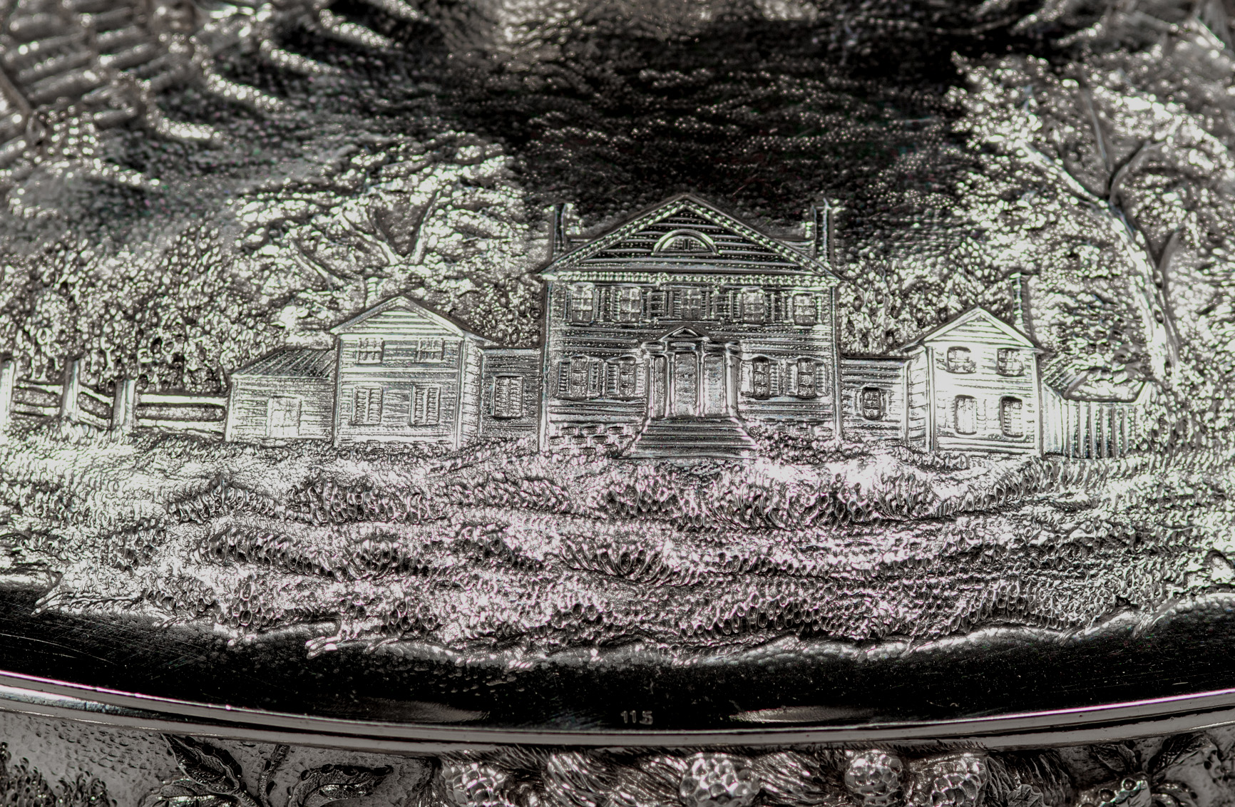 Wye House
|
This web site is presented for reference purposes under the doctrine of fair use. When this material is used, in whole or in part, proper citation and credit must be attributed to the Maryland State Archives. PLEASE NOTE: The site may contain material from other sources which may be under copyright. Rights assessment, and full originating source citation, is the responsibility of the user.
|
© Copyright
August 07, 2024
Maryland
State Archives


