Filet Platter, Allegany County
From the USS Maryland Silver Service
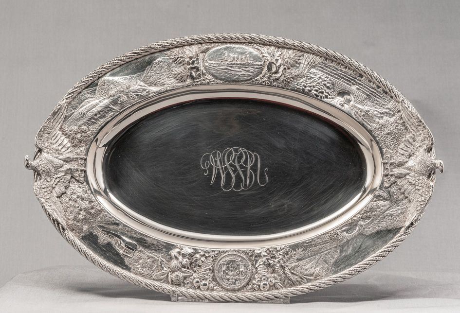
Maker: Samuel Kirk & Sons (1815-1979)
Object: Fillet Platter, Allegany County
Date: 1906
Medium: Sterling Silver
Dimensions:
Overall length (eagle to eagle) 16 1/2"; Overall width,10 3/4"
Accession number: MSA SC 1545-0936
The western county of Allegany is represented by a large fillet platter, which is similar in design to the Howard County roast platter. Allegany County was formed in 1789 from Washington County, and is one of three counties not named for an individual. Its name comes from the Native American word, oolikhanna, meaning "beautiful stream."
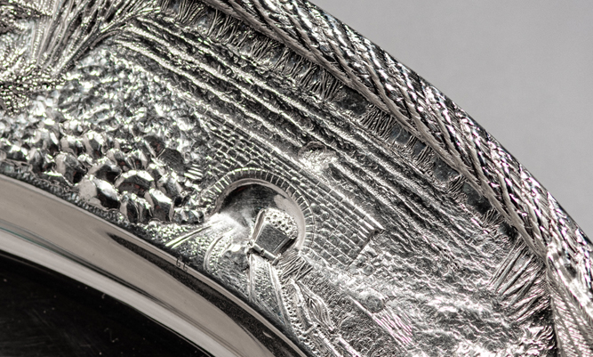
The fillet platter is decorated with four scenes that reflect the importance of the county’s role in the westward migration of the eighteenth and nineteenth centuries. Cornucopias of apples flank the Great Seal of Maryland, and these are surrounded by sprays of chestnut, oak and pine. Sprays of oak, birch, hemlock, and grain surround the Cruiser, and a clump of cattails appear to the right of the boat. As with the other serving platters, the “USSM” monogram is engraved in the center, two eagles are applied to the sides, and the rope border surrounds the perimeter.
Scenes across the top (left to right):1. Stone Bridge at Will’s Creek Narrows (number 63)
A more efficient route through Will’s Creek Narrows required a stone bridge to be constructed. It was completed in 1837 and was in use until 1932. In the 1950s, the bridge was torn down for the construction of a new flood control system.
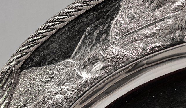
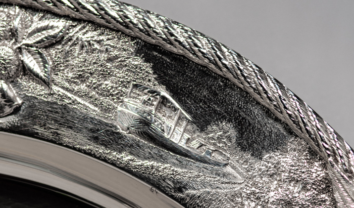
3. Chesapeake and Ohio Canal (number 64)
Today, the canal is used as a recreational trail managed by the National Park Service.
Scenes across the bottom (right to left)
1. Fort Cumberland (number 65)
The fort ceased to be used as a military base after the revolutionary war, however, it was used by President George Washington in 1794 in connection with the suppression of the Whiskey Rebellion in Western Pennsylvania. Since the fort was not situated in the most strategic location, it was gradually dismantled and disappeared.
2. USS Maryland Cruiser
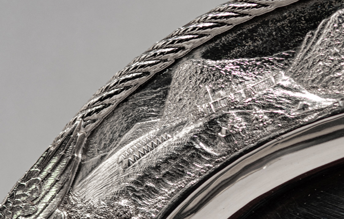
3. George’s Creek Coal Field [coal for the USS Maryland was taken from this mine] (number 66)
The mountains of Western Maryland provided one of the state's largest natural resources, coal. The fields of the Cumberland Valley were considered to be some of the richest in the country. The George’s Creek Coal Field was opened in 1840, and the high quality, semi-bituminous coal that was produced there was used throughout the state and traded around the world. In fact, the U.S. Navy, including the cruiser Maryland, used coal from this field.
This scene depicts an entrance to one of the coal mines with a loaded car on the tracks.
|
This web site is presented for reference purposes under the doctrine of fair use. When this material is used, in whole or in part, proper citation and credit must be attributed to the Maryland State Archives. PLEASE NOTE: The site may contain material from other sources which may be under copyright. Rights assessment, and full originating source citation, is the responsibility of the user. |
© Copyright August 06, 2024 Maryland State Archives
