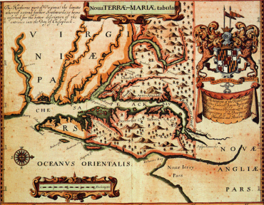
Maryland
Colonial Society Essay Contest, 2008
Theme: �Finding Maryland's Place in the World �
��
How has the visual representation of Maryland's place in the
world changed from colonial times to the present? In placing
Maryland on the map, what interesting features did
cartographers highlight over time? Have those elements changed
or stayed the same? Why? How have the methods of mapping
changed and how have those changes influenced the resulting
maps? Has the use of maps changed over time?
�_____________________________
Submissions may be either in the form of a Powerpoint, a
web-based presentation, or a Word, WordPerfect, or other word
processing document. Careful attention should be paid to the
citation of sources. Please avoid extensive quoting from any
source without giving the full source citation.
The prize for the best presentation will be awarded on Maryland
Day, Tuesday, March 25, 2008.
Using the
Maryland State Archives Atlas of Historical Maps (2003),
the Maryland State Archives web site (http://mdsa.net) and
Mapping Maryland: The Willard Hackerman Collection (1998),
as well as online map resources such as the Library of Congress
(http://memory.loc.gov/ammem/browse/ListSome.php?category=Maps)
and The David Rumsey Map Collection
(http://www.davidrumsey.com/), students are invited to
create an illustrated presentation or illustrated written essay on
how and why Maryland came to be a place on the map. In doing so,
choose one or more maps that interest you the most and explain
why. Particular attention might be paid to what strikes you as
strange and different from a modern map of Maryland, as state
highway map for example.
Prize for the best presentation based on the above theme:
- $200 cash prize
- Winners may also be offered the opportunity of a prestigious paid summer internship in Maryland history at the Maryland State Archives in Annapolis�
The contest is open to any interested Maryland high school student or class, and teachers are encouraged to use the contest as a class assignment.
Deadline: March 14, 2008