| f'ashington and the Potomac 711
q. not clearly understood-all subscriptions should be by shares is the
[torn].
$. can this be amended.
6. Number too disportionate to the agregate especially as many votes
may happen to be in the same person.
Little and lower falls unnecessary. A place below the confluence of
the No. and So. Branch substituted in place of the lower falls.
8. Alter the rates of the tolls.
9. Why that exemption when the returns for the produce of the Ohio
w'ch may go down the Mississippi may go back in the empty
Boats.
to. with a reasonable space, say ~o feet on each side (if necessary).
it. This clause gives great discontent, as it is construed to make the
Company insurers and answerable for all damages such works
may sustain.
tz. A consequent alteration, if (;) is made.
13. Sufficient Locks-if they shall be found necessary.
* And that may use force to prevent their passing spot if it is at-
tempted without. Would it be nugatory to insert a clause to empower
the corporation to lower the Falls if they shall deem it necessary without
an Act of Assembly,-or what follows may answer
* or any less Tons at their discretion.
[Endorsement:1 Obs'ns on the Acts for opening the Navigation of
Potomac and James Rivers. 1784.
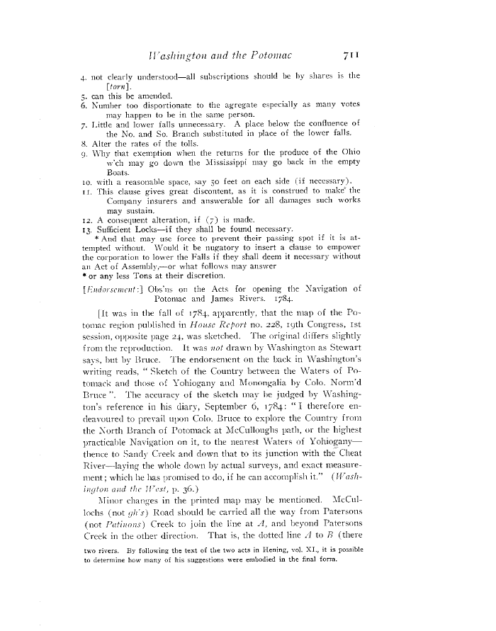
[It was in the fall of 1784. apparently, that the map of the Po-
totnac region published in House Report no. 228, 19th Congress, 1st
session. opposite page aq, was sketched. The original differs slightly
f rom the reproduction. It was not drawn by- Washington as Stewart
says, but by Bruce. The endorsement on the back in Washington's
writing reads, " Sketch of the Country between the NVaters of Po-
tomack and those of Yohiogany and Mcvnongalia by Colo. Norm'd
Bruce ". The accuracy of the sketch tnay he judged by Washing-
ton's reference in his diary, September 6, 1784: " I therefore en-
deavoured to prevail upon Colo. Bruce to explore the Country from
the North Branch of Potomack at McCulloughs path, or the highest
practicable Navigation on it, to the nearest Waters of Yohiogalry-
thence to Sandy Creek and down that to its junction with the Cheat
River-laying the whole down by actual surveys, and exact measure-
ment; which he has promised to do, if he can accomplish it." ( II'ash-
ington and thr ll't°st, P. 36.)
Minor changes in the printed map tray be mentioned. 1TcCul-
lochs (not gh's) Road should he carried all the way from Patersons
(not Patinons) Creek to join the line at A, and beyond Patersons
Creek in the other direction. That is, the dotted line fl to 73 (there
two rivers. By following the text of the two acts in Hening, vol. XL, it is
possible
to determine how many of his suggestions were embodied in the final form.
|