| 00441 f~W
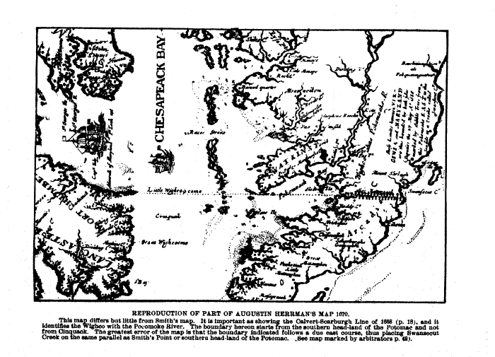
REPRODUCTION OF PART OF AUGUSTIN HERRMAN'S MAP 1670.
This map differs but little from Smith's map. It is important as showing the Calvert-Scarburgh Line of 1688 (p. 18), and it identifies the Wighco with the Pocomoke River. The boundary hereon starts from the southern head-land of the Potomac and not from Cinquack. The greatest error of the map is that the boundary indicated follows a due east course, thus placing Swansecut Creek on the same parallel as Smith's Point or southern headland of the Potomac. See map marked by arbitrators p.42
|